استفسر الآن
المسح الطبوغرافي والهيدروغرافي في الإمارات | خدمات رسم خرائط الأراضي والسواحل والمناطق البحرية
توفر خدمات المسح الطبوغرافي والهيدروغرافي في الإمارات معلومات دقيقة عن الأراضي والمناطق تحت الماء لمشاريع الإنشاء والبنية التحتية والمشاريع الساحلية والبحرية في دبي وأبوظبي والعين والشارقة ومختلف أنحاء دولة الإمارات. وبينما تركز المسوحات الطبوغرافية على قياس تضاريس سطح الأرض ومعالمها، تهتم المسوحات الهيدروغرافية برسم خرائط أعماق المياه وخصائص قاع البحر والظروف الموجودة تحت الماء. ويساعد الجمع بين هذين النوعين من المسوحات المهندسين على تكوين فهم أوضح لموقع المشروع قبل بدء أعمال التطوير.
كما تساعد معلومات المسح الدقيقة الاستشاريين والمقاولين والمطورين على تخطيط المشاريع بثقة أكبر. ومن خلال دمج بيانات الأراضي والمناطق البحرية مع التقييمات الهندسية، يمكن لفرق المشروع تحديد قيود الموقع في مرحلة مبكرة وتقليل المخاطر غير المتوقعة أثناء الإنشاء.
المسح البري وتحت الماء لمشاريع الإمارات
يتميز كل موقع تطوير بظروف طبيعية مختلفة. ولذلك، يعد المسح الدقيق أمرًا مهمًا لفهم التضاريس الحالية والارتفاعات والحدود وأعماق المياه وخصائص قاع البحر قبل بدء أعمال التصميم والإنشاء.
يركز المسح الطبوغرافي على الظروف الموجودة على اليابسة، بينما يختص المسح الهيدروغرافي بالبيئات الموجودة تحت الماء. بالإضافة إلى ذلك، يمكن دمج نتائج كلا النوعين من المسوحات مع خدمات التحقيق في الموقع للحصول على رؤية أكثر شمولًا لمنطقة المشروع.
المسح الطبوغرافي في الإمارات لتطوير الأراضي
يسجل المسح الطبوغرافي الخصائص الطبيعية للموقع، بما في ذلك الارتفاعات والانحدارات وتغيرات التضاريس والمنشآت القائمة والطرق وخصائص تصريف المياه وغيرها من العناصر الظاهرة. ونتيجة لذلك، يمكن للمهندسين والمعماريين الاعتماد على معلومات دقيقة عن الموقع خلال مراحل التخطيط والتصميم.
رسم خرائط التضاريس وتقييم الموقع
يساعد رسم خرائط التضاريس التفصيلي على تحديد مناسيب الأرض الحالية والتعرف على الاختلافات الموجودة في أنحاء موقع التطوير. كما يمكن الاستفادة من هذه المعلومات في أعمال تسوية الأرض وتصريف المياه وتحديد مسارات الطرق وتخطيط البنية التحتية والاستعداد لأعمال الإنشاء.
- رسم خرائط الموقع والتضاريس
- بيانات الارتفاعات وخطوط الكنتور
- تخطيط الطرق والبنية التحتية
- تخطيط شبكات تصريف المياه والمرافق
- دعم مشاريع تطوير وتقسيم الأراضي
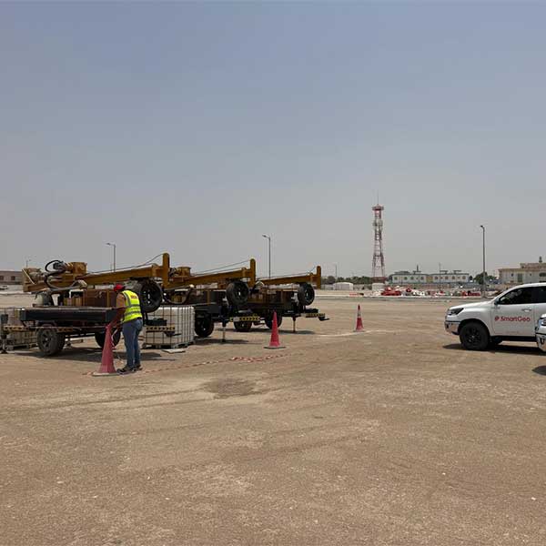
- مسوحات مواقع الإنشاء
تطبيقات المسح في دبي وأبوظبي والعين
تُعد المسوحات الطبوغرافية مفيدة للمجمعات السكنية والمشاريع التجارية والطرق وشبكات المرافق والمنشآت الصناعية ومشاريع البنية التحتية. فعلى سبيل المثال، قد تحتاج المواقع الحضرية المعقدة في دبي إلى رسم خرائط تفصيلية للسطح، بينما يمكن لمناطق التطوير الكبيرة في أبوظبي والعين الاستفادة من بيانات دقيقة عن التضاريس والارتفاعات.
المسح الهيدروغرافي في الإمارات للتطوير البحري
يركز المسح الهيدروغرافي في الإمارات على البيئات الموجودة تحت الماء، مثل السواحل وقاع البحر والممرات المائية والموانئ والمرافئ والمناطق البحرية. وتعمل هذه المسوحات على قياس أعماق المياه وتحديد التغيرات في ظروف قاع البحر التي قد تؤثر في أعمال الإنشاءات البحرية.
وبالتالي، تساعد المعلومات الهيدروغرافية الدقيقة المهندسين على التخطيط للمنشآت البحرية وأعمال التكريك ومشاريع الاستصلاح والتطوير الساحلي بدرجة أكبر من الثقة.
رسم خرائط قاع البحر والبيانات الباثيمترية
يوفر المسح الهيدروغرافي معلومات تفصيلية عن مناسيب المناطق تحت الماء وخصائص قاع البحر. كما يمكن استخدام البيانات التي يتم جمعها لإنشاء نماذج باثيمترية دقيقة لأغراض الهندسة والتخطيط البحري.
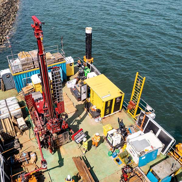
وبالنسبة إلى المشاريع التي تتطلب رسم خرائط لقاع البحر إلى جانب الحصول على معلومات عن الطبقات الموجودة تحته، يمكن دمج البيانات الهيدروغرافية مع التحقيق الجيوتقني البحري. ويساعد هذا التكامل المهندسين على فهم سطح قاع البحر والظروف الجيوتقنية الموجودة أسفله.
تطبيقات المسح البحري في الإمارات
- تطوير الموانئ والمرافئ
- مشاريع البنية التحتية الساحلية
- أعمال التكريك والاستصلاح
- أعمال الإنشاءات البحرية
- تخطيط خطوط الأنابيب والمرافق البحرية
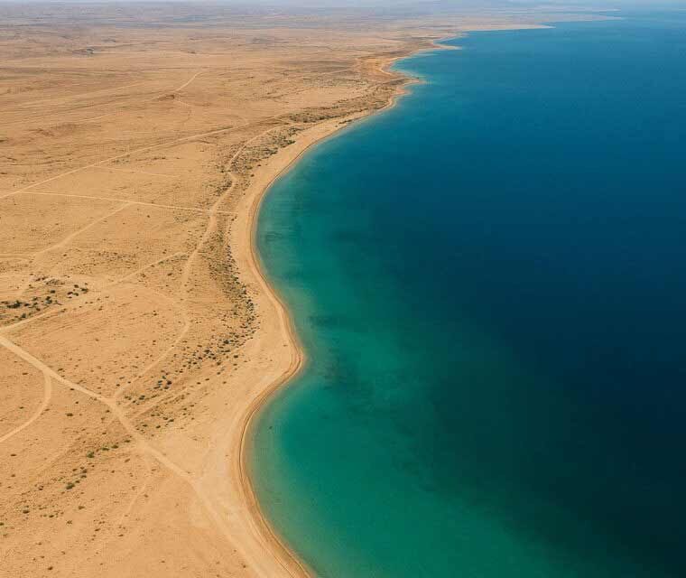
- تقييم قاع البحر وخطوط الشاطئ
- مشاريع تطوير الواجهات البحرية
بيانات المسح الطبوغرافي والهيدروغرافي للمشاريع الساحلية
غالبًا ما تحتاج مشاريع التطوير الساحلي إلى معلومات عن اليابسة والمياه في الوقت نفسه. ولذلك، يمكن أن يؤدي الجمع بين المسوحات الطبوغرافية والهيدروغرافية إلى إنشاء صورة أكثر شمولًا للمنطقة الانتقالية بين خط الشاطئ وسطح الأرض وقاع البحر.
ويُعد هذا النهج مفيدًا بشكل خاص لمشاريع الواجهات البحرية والموانئ وأعمال حماية السواحل ومشاريع الاستصلاح وغيرها من مشاريع البنية التحتية البحرية في أبوظبي ودبي والشارقة والمناطق الساحلية الأخرى في دولة الإمارات.
وللحصول على معلومات إضافية حول أعماق المياه، يمكن للمشاريع أيضًا الاستفادة من خدمات المسح الباثيمتري لدعم أعمال الهندسة البحرية والتخطيط لمشاريع التطوير.
كيف تدعم بيانات المسح القرارات الهندسية؟
تزداد قيمة معلومات المسح عند تحليلها إلى جانب نتائج التحقيقات الأخرى في الموقع. ولهذا السبب، يمكن لشركة SmartGeo دمج بيانات المسح مع خدمات الهندسة الجيوتقنية لدعم تخطيط الأساسات والبنية التحتية.
كما يمكن أن تساعد الدراسات الجيوفيزيائية الإضافية في دراسة الظروف الموجودة تحت سطح الأرض والتي لا يمكن تحديدها من خلال رسم خرائط السطح وحده. ويتيح هذا النهج المتكامل لفرق المشروع اتخاذ القرارات بالاعتماد على معلومات مستمدة من أساليب مختلفة للتحقيق في الموقع.
تقنيات المسح المتقدمة
تستخدم مشاريع المسح الحديثة تقنيات متقدمة لتحديد المواقع والقياس والتصوير ومعالجة البيانات بهدف تحسين الدقة والكفاءة. وبناءً على طبيعة الموقع ومتطلبات المشروع، يمكن اختيار الأساليب المناسبة لجمع المعلومات التي يحتاج إليها المهندسون والاستشاريون.
وبالنسبة إلى المشاريع التي تتطلب رسم خرائط للطبقات القريبة من سطح الأرض، يمكن أن يكمل مسح GPR معلومات المسح السطحي والبحري من خلال تحديد المرافق المدفونة والتجاويف وغيرها من الخصائص الموجودة تحت سطح الأرض.
خدمات المسح في دبي وأبوظبي والعين والشارقة
تدعم SmartGeo متطلبات المسح في مختلف أنحاء دولة الإمارات، بما في ذلك مناطق التطوير الرئيسية في دبي وأبوظبي، ومشاريع الأراضي في العين، ومشاريع البنية التحتية والتطوير التجاري في الشارقة. كما يمكن لخدماتنا دعم المشاريع في الإمارات الأخرى وفقًا لظروف الموقع ومتطلبات المشروع.
سواء كان المشروع يتطلب رسم خرائط للأراضي أو تطويرًا ساحليًا أو تقييمًا لقاع البحر أو تحقيقًا متكاملًا للموقع، فإن بيانات المسح الدقيقة توفر أساسًا مهمًا للتخطيط الفعال للمشروع.
لماذا تختار SmartGeo لخدمات المسح؟
يساعد اختيار مزود خدمات مسح ذي خبرة على ضمان جمع القياسات الميدانية بطريقة منهجية وتقديمها في صيغة مناسبة للاستخدامات الهندسية. كما يمكن أن يساهم تنسيق أعمال المسح في تقليل الحاجة إلى تكرار القياسات الميدانية وتحسين التواصل بين المسّاحين والمهندسين والاستشاريين والمقاولين.
- خبرة في أعمال المسح والهندسة الجيوتقنية
- استخدام أساليب متقدمة للمسح البري والبحري
- بيانات مسح تفصيلية وتقارير فنية
- دمج أعمال المسح مع التحقيقات الجيوتقنية والجيوفيزيائية
- دعم مشاريع الإنشاء والبنية التحتية والمشاريع البحرية
- تغطية دبي وأبوظبي والعين والشارقة ومختلف أنحاء دولة الإمارات
الخلاصة
توفر خدمات المسح الطبوغرافي والهيدروغرافي في الإمارات معلومات أساسية لفهم البيئات البرية وتحت الماء. فمن مشاريع التطوير الحضري وتخطيط البنية التحتية إلى الموانئ ومشاريع الواجهات البحرية والإنشاءات الساحلية، تساعد بيانات المسح الدقيقة المهندسين على تكوين صورة أوضح عن الظروف الحالية للموقع.
وعند دمج المسح مع فحص التربة والتحقيق في الموقع والتحليل الجيوتقني البحري، يصبح المسح جزءًا من استراتيجية متكاملة لتقييم الموقع. ولذلك، تساعد SmartGeo المطورين والاستشاريين والمقاولين على اتخاذ قرارات مدروسة لتنفيذ مشاريع أكثر أمانًا وكفاءة في مختلف أنحاء دولة الإمارات.