Enquire Now
Topographic & Hydrographic Surveying Services in UAE
SmartGeo is a trusted leader in providing precise topographic and hydrographic survey services in Dubai, Abu Dhabi, Al Ain and across the UAE and the wider Middle East. Backed by advanced technologies, expert surveyors, and years of field experience, we deliver detailed spatial data critical for infrastructure, coastal development, and environmental planning projects.
Precision Surveys for Land and Marine Environments
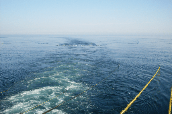
Our in-house team utilizes advanced GPS, total stations, drones, echo sounders, and sonar systems to deliver highly accurate topographic and bathymetric data. Whether you’re planning a construction project on land or a marine development nearshore, SmartGeo provides the clarity you need to move forward with confidence.
Our Capabilities
We offer a wide range of surveying services, including:
- Topographic Surveys: Accurate mapping of land elevations, contours, and man-made features.
- Hydrographic Surveys: Detailed seabed mapping using single-beam and multi-beam sonar systems.
- Bathymetric Surveys: High-resolution underwater topography to support marine construction and dredging.
- Laser Scanning & 3D Modeling: Capturing complex surfaces for modeling, planning, and volume calculations.
- Utility Detection & Mapping: Locating underground pipes, cables, and other utilities with GPR and EM tools.
- Seabed Sediment Sampling & Analysis: Environmental and geotechnical assessment of underwater soil conditions.
- Tidal & Current Monitoring: Using ADCP and tide gauges for precise coastal behavior analysis.
- As-Built Surveys: Post-construction validation to ensure accurate implementation of designs.
- Plot Demarcation & Boundary Surveys: Legal boundary definition for property development and land registration.
- Pipe Route Surveys: Planning and marking of underground service lines.
Advanced Equipment & Skilled Team
SmartGeo integrates cutting-edge surveying equipment with the expertise of trained professionals to ensure consistent, high-quality data collection in any terrain or marine setting. Whether mobilizing boats with mounted sonar systems or deploying UAVs for aerial topographic surveys, we adapt to your project’s unique requirements.
Applications Across Industries
Our topographic and hydrographic services support various sectors:
- Urban planning and infrastructure
- Coastal and marine engineering
- Environmental monitoring
- Oil & gas and utility route planning
- Dredging and reclamation projects
- Port and harbor development
Why Choose SmartGeo?
- ISO-Certified QHSE Standards
- In-house team & equipment
- Experience across UAE & GCC
- Fast turnaround with accurate results
- Customized reports and CAD/GIS deliverables
Let’s Build With Precision
From the depths of the ocean floor to complex land terrains, SmartGeo delivers accurate insights that drive smart decisions. Contact us today to discuss your topographic or hydrographic survey needs.
📞 +971 3 721 1121
📧 info@smartgeo.ae