Enquire Now
Topographic & Hydrographic Surveying Services in UAE | Dubai, Abu Dhabi & Al Ain
SmartGeo is a trusted provider of topographic survey, hydrographic survey, and bathymetric survey services in UAE, delivering accurate spatial data across Dubai, Abu Dhabi, Al Ain, and the wider Middle East. Our surveying solutions support infrastructure development, marine engineering, coastal projects, and environmental planning.
We integrate advanced geophysical survey, ground investigation, and geotechnical services to ensure complete subsurface and surface understanding for safe and efficient project execution.
Our survey data is often validated through our soil testing and geotechnical laboratory to ensure engineering accuracy and compliance with UAE construction standards.
Topographic Survey Services in UAE
Our topographic survey services in UAE provide accurate mapping of land features, elevations, and site boundaries using advanced GPS, total stations, and drone technology.
- Topographic survey UAE for land development and infrastructure planning
- Plot demarcation and boundary surveys for legal land registration
- As-built surveys for construction verification
- Utility detection and mapping using GPR and EM tools
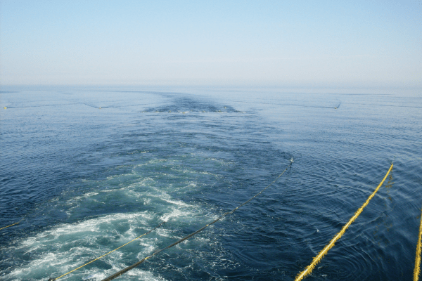
Hydrographic & Bathymetric Survey Services
SmartGeo provides advanced hydrographic survey and bathymetric survey services in UAE for marine and coastal development projects.
- Bathymetric survey UAE for underwater terrain mapping
- Hydrographic surveys for ports, harbors, and coastal infrastructure
- Seabed sediment analysis and marine environmental assessment
- Side scan sonar and echo sounder-based seabed mapping
Laser Scanning & 3D Survey Solutions
We offer advanced laser scanning and 3D modeling solutions for complex construction and engineering projects in UAE.
- 3D laser scanning for detailed surface modeling
- Volume calculations for excavation and earthworks
- CAD and GIS deliverables for engineering design
- High-accuracy digital terrain modeling (DTM)
Utility Mapping & Ground Investigation Support
SmartGeo integrates ground investigation and subsurface detection techniques to support safe construction planning.
- Ground investigation UAE for subsurface analysis
- GPR survey UAE for underground utility detection
- Pipeline route surveys for infrastructure development
- Utility mapping for construction safety
Applications of Our Surveying Services
- Urban planning and infrastructure development in Dubai
- Coastal and marine engineering projects in Abu Dhabi
- Oil & gas and utility corridor planning
- Dredging and land reclamation projects
- Port and harbor development across UAE
- Environmental monitoring and risk assessment
Why Choose SmartGeo?
- Experienced survey engineers and geospatial specialists
- Advanced GPS, sonar, UAV, and scanning technologies
- Integrated geotechnical services and soil testing support
- Fast turnaround with accurate reporting
- Strong presence across UAE, Dubai, Abu Dhabi & GCC region
SmartGeo delivers precise topographic survey, hydrographic survey, and bathymetric survey services in UAE, ensuring accurate data for safer, smarter, and more efficient construction and marine development projects.
+971 3 721 1121
info@smartgeo.ae